 |
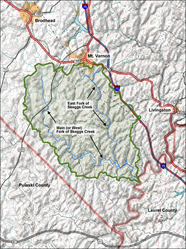
The Skeggs Creek watershed, outlined in green on the map below, encompasses almost 56 square miles (35,840 acres) of land south of Mt. Vernon in Rockcastle County, Kentucky. Major adjacent watersheds are: Dix River (including Negro and Renfro Creek) to the north, Roundstone Creek to the east, Rockcastle River to the south and east, Line Creek to the south, and Buck Creek/Sinking Valley/Brush Creek to the west.  |